
Navigate through changing GPS.
Rahbar keeps pedestrian motion processing active when GPS quality declines and uses future valid fixes to correct the fused estimate according to their quality.
GPS / PDR FUSIONBring reliable, motion-aware positioning to your outdoor app—from trail hikes to urban walks, even when GPS is unreliable or unavailable.

The positioning
is Rahbar.
Rahbar is an offline-first iOS navigation SDK that combines Core Motion, GPS, pedestrian dead reckoning, and uncertainty-aware fusion. Your app receives a fused position designed to continue through degraded or unavailable GPS conditions.
Rahbar keeps pedestrian motion processing active when GPS quality declines and uses future valid fixes to correct the fused estimate according to their quality.
GPS / PDR FUSIONPosition output includes horizontal, directional, and vertical uncertainty plus quality and degradation states, so your app can make informed decisions.
QUALITY-AWARE OUTPUTYour app owns maps, routes, UI, persistence, and sharing. Rahbar requires no account or network connection for navigation and does not upload coordinates, tracks, or diagnostics.
OFFLINE-FIRSTRahbar combines iOS Core Motion attitude and inertial data with GPS, Core ML pedestrian motion inference, and uncertainty-aware GPS/PDR fusion.
The host app may also supply independent absolute or relative position measurements. Rahbar applies them according to their stated uncertainty rather than treating them as hard teleports.
Talk through your integrationRahbar owns acquisition, normalization, fusion, inference, uncertainty, calibration, and session tracks. Your app owns the user experience.
Add the signed XCFramework to an iOS app, choose how position should be expressed, and consume fused updates through a single long-lived RahbarNavigation instance.
Use fused geographic coordinates for trail, urban, and map-based navigation. Start from the first valid GPS fix or a known coordinate.
Start from a relative origin and render meter-based output against a floor plan. Independent relative measurements can refine the estimate.
Add RahbarSDK.xcframework as Embed & Sign, import RahbarSDK, and provide Location and Motion usage descriptions.
Select .geodetic or .relativeENU, the initial GPS-fusion state, and whether active navigation may continue in the background.
Create one RahbarNavigation, request authorization, call start(), then begin a session from automatic GPS, a manual coordinate, or a relative origin.
Use position for navigation, including its uncertainty and source. Use motion, calibration, lifecycle, and quality fields to explain current behavior. Keep rawGPS diagnostic-only.
import RahbarSDK

let config = RahbarConfiguration(
    positionOutputMode: .geodetic,
    gpsFusionEnabled: true,
    allowsBackgroundLocationUpdates: true,
    showsBackgroundLocationIndicator: true
)

let navigation = try RahbarNavigation(
    configuration: config
)

_ = navigation.requestAuthorization()

Task {
    for await update in navigation.updates {
        let fused = update.position
        let gps = update.rawGPS // diagnostics only
        let quality = update.quality
    }
}

try navigation.start()The Simulator can validate API integration, but it cannot reproduce real motion, GPS, uncertainty growth, background behavior, or battery use.
Plot Rahbar’s fused position and uncertainty separately from raw GPS and its reported accuracy.
Disable GPS corrections at runtime while raw GPS remains visible, then observe PDR behavior, uncertainty growth, and recovery.
Inject absolute or relative measurements with realistic uncertainty. Rahbar weights the correction instead of snapping to it.
Explore Rahbar’s positioning capabilities through our iOS evaluation app, from a trail on USGS Topo to an urban walk on Apple Maps.
Request an evaluation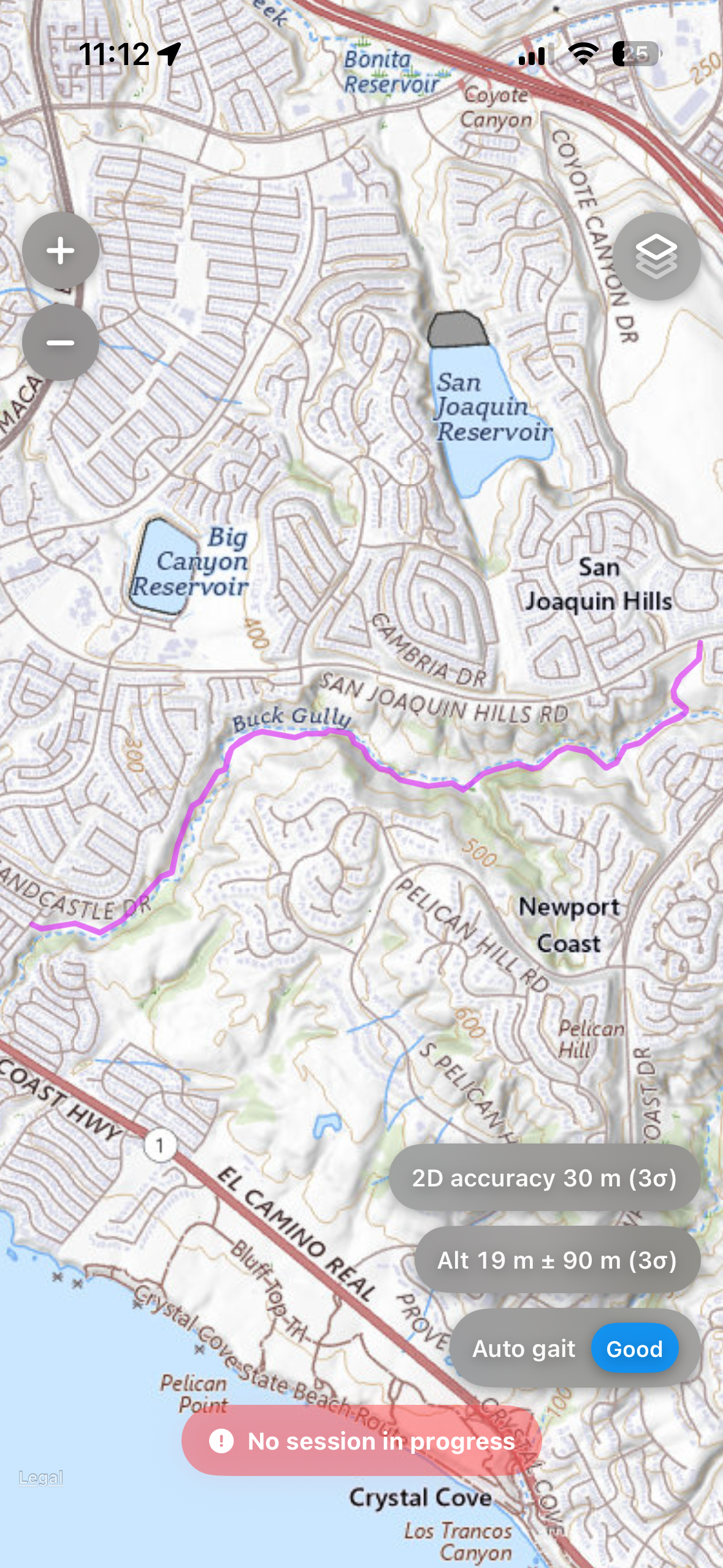
Follow a recorded path alongside terrain contours and landmarks. The evaluation app also supports downloadable USGS Topo maps for offline use.
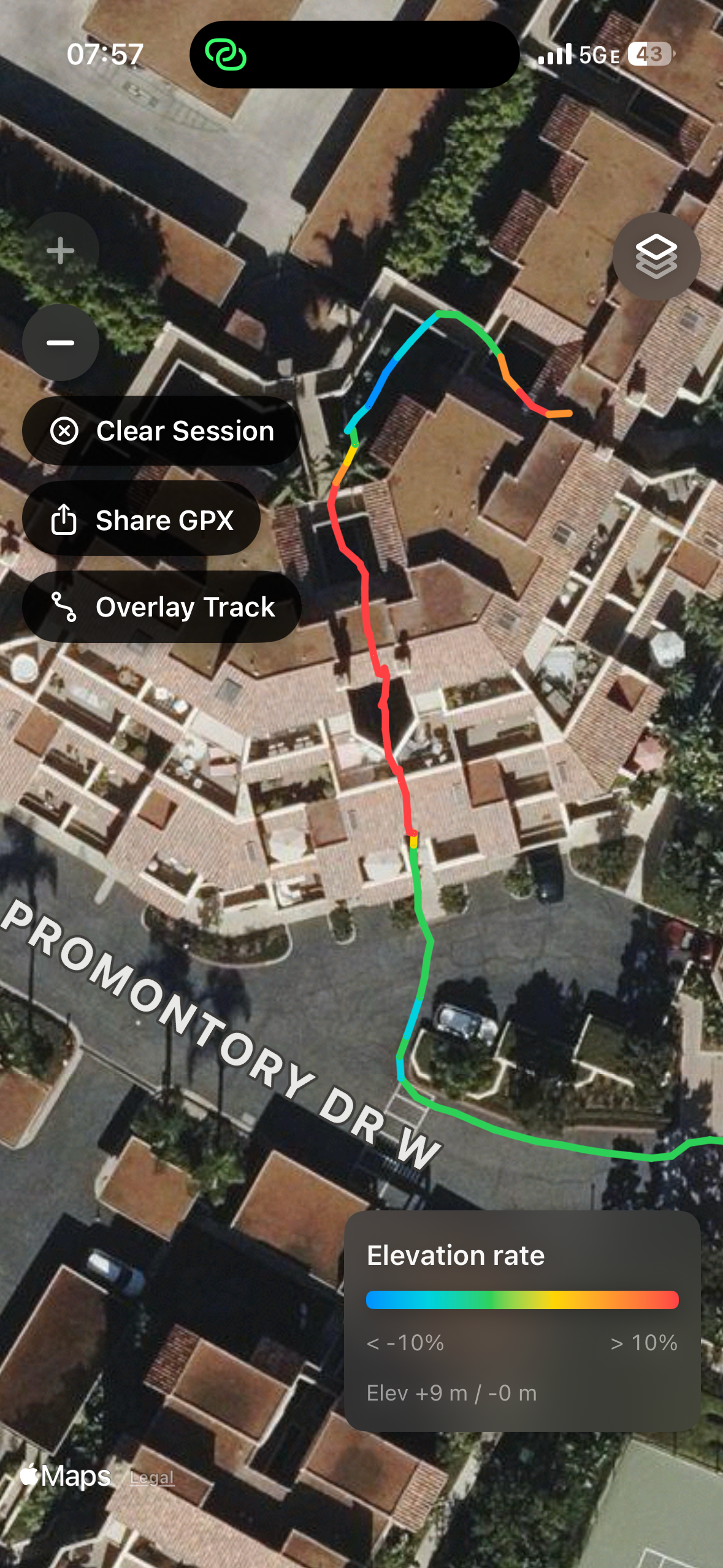
The recorded path remains continuous as the user moves from the street through a building complex—an environment where GPS-only positioning commonly degrades or drops out.
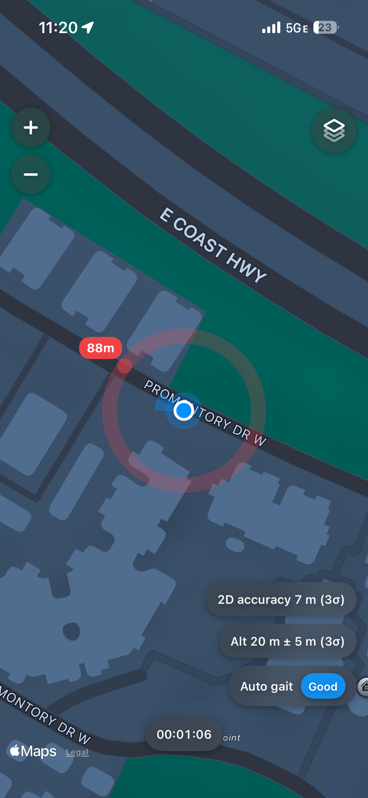
See distance and direction cues to a selected waypoint as you move, alongside positioning and altitude estimates.
Screenshots from the Rahbar iOS evaluation app. SDK scope and integration requirements are discussed separately.